These are 10 of the best hikes near Seattle. All of the below hikes can be accessed within a day’s drive and they provide some of the best scenery in Washington State.
Each hike will be rated out of 5 points based on scenery, difficulty and solitude.
Hiking near Seattle is near some of the best hikes in the country. If you’re looking for great hiking you’ll have a huge variety of terrain to choose from. Whether it’s alpine lakes, waterfalls, rugged peaks, or wide-open meadows, hiking near Seattle has it all.
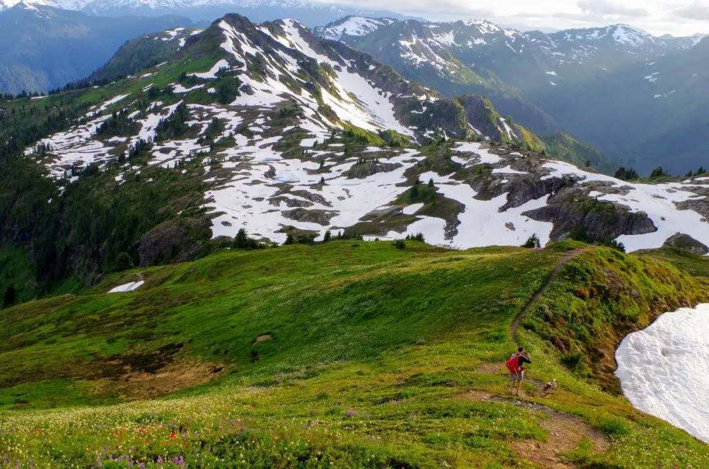
1 – Yellow Aster Butte (North Cascades).
Round Trip Miles: 7.5.
Elevation Gain: 2550 ft.
Difficulty: 3/5
Scenery: 5/5
Solitude: 2/5
Best time of year to hike: July-October
There is no shortage of views on the trail to Yellow Aster Butte. The trail begins with steep switchbacks through vast fields of wildflowers. If you’re here during late July/August, the wildflowers are some of the best in the Pacific Northwest. However, the foliage in October is just as beautiful.
Eventually, after about 3.5 miles of hiking, the views really open up and you’ll find yourself surrounded by stunning views of the surrounding peaks of the North Cascades. Below, you will see numerous tarns dotting the landscape. There’s a faint boot path leading down to the tarns.
This can be a great place to camp, but expect plenty of company on a sunny weekend. Overall, this is one of the most scenic and best hikes in the North Cascades, but it gets very busy on summer weekends due to its proximity to Seattle.
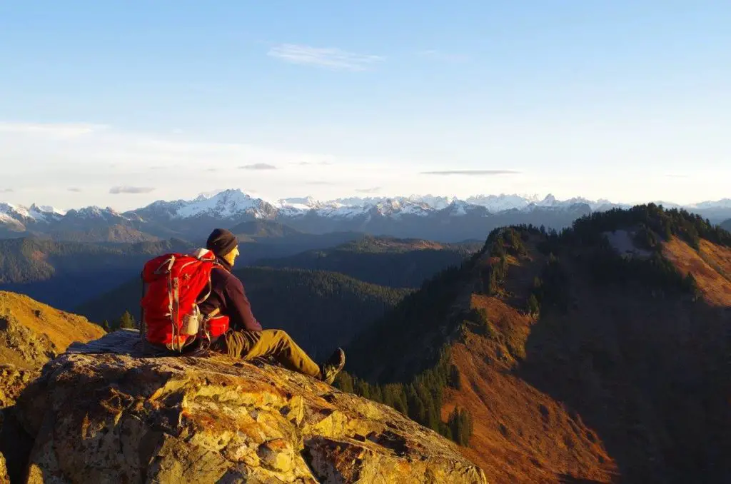
2 – Sauk Mountain (North Cascades)
Round Trip Miles: 4.2
Elevation Gain: 1200
Difficulty: 2/5
Scenery: 5/5
Solitude: 2/5
Best time of year to hike: July-October
Hiking Sauk Mountain offers some of the best bang-for-your-buck views in the entire state and is an easy drive from Seattle and the surrounding areas.
The views start the moment you leave your car and only get better as you hike your way to the top. The short distance makes this an ideal hike to catch the sunrise. Despite being a mere 2.1 miles to the summit, you will feel like you’re deep in the Cascade Mountains.
However, make no mistake, this hike is not a walk in the park. There are very steep and exposed sections. In 2017, a hiker slipped and fell, causing her death. Use caution and make sure you stay on the trail.
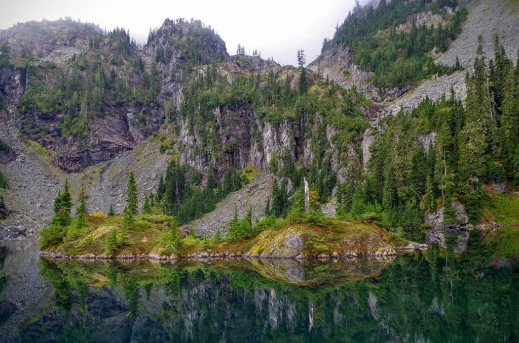
3 – Rock Lake
Round Trip Miles: 5.0
Elevation Gain: 3400
Difficulty: 4/5
Scenery: 4/5
Solitude: 4/5
Best time of year to hike: July-October
Rock Lake is a lesser known gem that takes you to a stunning pristine alpine lake. However, this hike will make you earn your reward.
The trailhead starts near Evans Lake off of Highway 2. There is no trailhead sign, but there’s a discrete fisherman’s path that begins near the parking area.
Once you find the path, it’s fairly easy to follow all the way to the lake. The path heads upward through the forest and doesn’t relent for the next 2 miles, gaining over 3000 ft. of elevation gain along the way.
Eventually, you will reach a high point with views of the surrounding mountains. Now, it’s time to descend to the lake. The path gets harder to follow at this point, but you will weave your way through brush and eventually break out of the forest and Rock Lake will appear in view.
A map/compass or GPS is highly recommended for this hike. Please pick up all your trash, as this area receives few visitors.
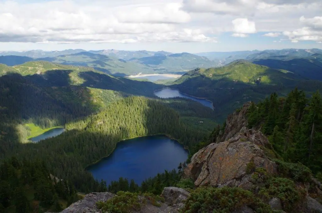
4 – Tinkham Peak
Round Trip Miles: 5.5
Elevation Gain: 2200
Difficulty: 3/5
Scenery: 4/5
Solitude: 4/5
Best time of year to hike: July-October
Hiking Tinkham Peak is a great way to get 360 degree mountain views and avoid the crowds.
Despite being located just off of Snoqualmie Pass with close proximity to Seattle, this one doesn’t receive too many visitors. There are multiple routes to the summit, but the quickest and easiest route is to park at the trailhead for Mirror Lake.
Follow the Mirror Lake trail until you reach a well-established campsite at the corner of the lake. There’s a faint, but relatively obvious boot path that heads up from the campsite. You may see “no trespassing” signs on your left as you head up. This is part of the cedar river watershed.
Heed the signs and continue on the main path. Eventually, after passing a few meadows, you will break out into the open and your objective will be in sight. As you make your way to the summit, be careful of the steep drop-offs.
5 – Sylvester Lake
Round Trip Miles: 5.0
Elevation Gain: 3800
Difficulty: 4/5
Scenery: 4/5
Solitude: 5/5
Best time of year to hike: July-October
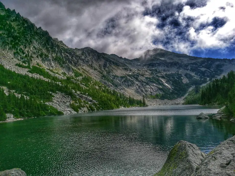
If your goal is to have a beautiful alpine lake all to yourself, Sylvester Lake is the place to go. Located in the popular Leavenworth area, this lake is overlooked and rarely receives visitors. Despite having a fairly good fisherman’s path, Sylvester Lake is largely unknown.
The parking area is located at the end of NF-7609. There’s a small pull-out area, just enough for a few cars. Although you’ll rarely have company on this hike. The fisherman’s path is easily spotted from the parking area. Fair warning – this hike doesn’t mess around.
There’s no switchbacks here, the trail just goes up and up. Eventually, you will break out into an open area with boulders blocking your path. This is where the “trail” ends. As long as you have a map, and know which direction the lake is, you should be fine, but it’s choose your own adventure from here.
Pick your way across the boulders and you’ll find yourself in a meadow, with very steep terrain directly to your left. Sylvester Lake is just on the other side. Catch your breath and climb steadily upwards. Once you’ve reached the high point, the lake is a mere 300 ft. of elevation below you.
Just when you think you’ll never find it, you’ll catch a glimpse of the lake between the trees. You made it. There’s not a lot of shoreline around the lake, but there’s a few spots where you can sit down and appreciate your efforts. If you still have energy, you can always climb Grindstone Mountain, which looms above Sylvester Lake.
6 – Minotaur Lake & Labyrinth Mountain
Round Trip Miles: 5.5
Elevation Gain: 2800
Difficulty: 3/5
Scenery: 4/5
Solitude: 3/5
Best time of year to hike: July-October
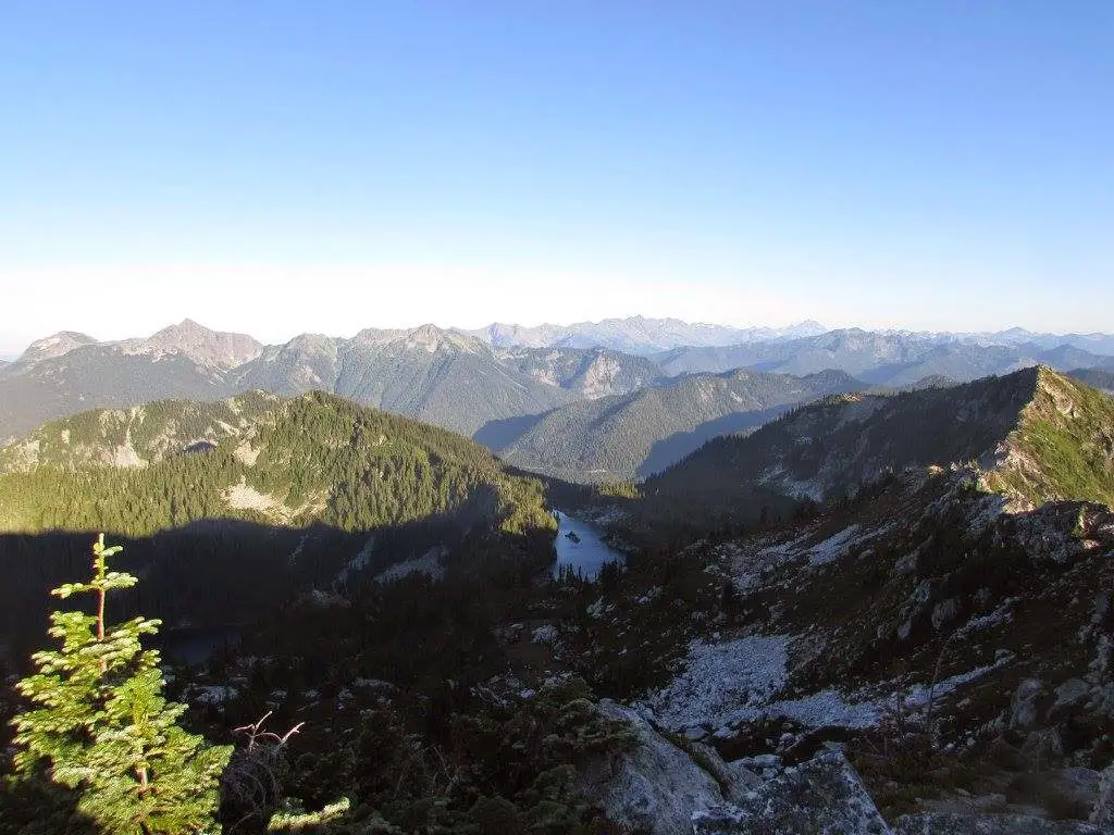
Minotaur Lake is located just a few miles east of Stevens Pass and only an hour plus from Seattle. Follow FS 6700 until you reach an intersection with FS 6704.
Drive on this road for about a mile to the parking area. The trailhead is signed and the trail begins in the forest. The hike is steep and the trail is very dusty. It wouldn’t hurt to have a pair of gaiters to avoid accumulating a bunch of dirt in your shoes. Before you know it, you’ll break out of the forest and into a meadow. The grade is much gentler at this point and it’s a short hike to the shores of Minotaur Lake.
You made it. But why stop here? Keep hiking the trail and you’ll come to Theseus Lake directly below you. While there’s no good path down to the lake, the path will continue and gain another 800 ft. of elevation, taking you to the summit of Labyrinth Mountain. The summit has fantastic views of Minotaur and Theseus Lakes, plus the surrounding cascade mountains.
7 – Summit Lake
Round Trip Miles: 6.0
Elevation Gain: 1300
Difficulty: 2/5
Scenery: 4/5
Solitude: 2/5
Best time of year to hike: July-October
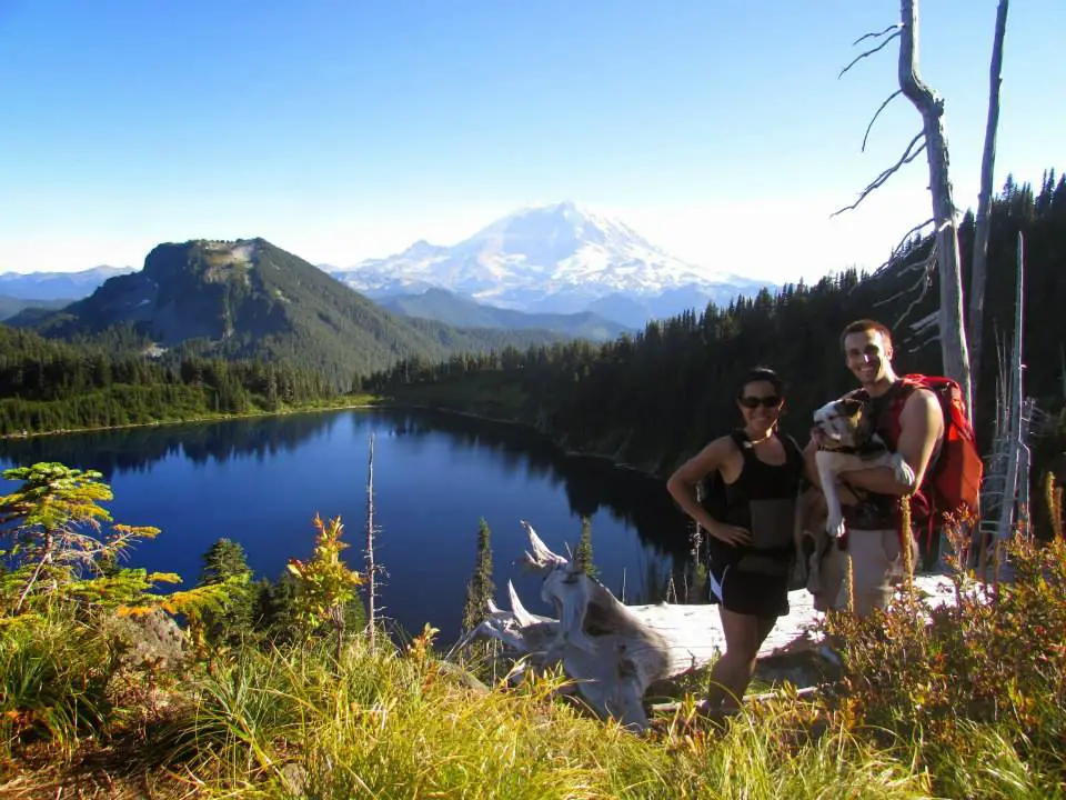
If you’re looking for great views of Mt. Rainier without actually visiting the National Park, this is the hike. Summit Lake is located just outside Mt. Rainier National Park and a short drive from Seattle, at the end of FR 7810, just off the Carbon River Road.
If you love hiking with your dog, this is a big advantage. The hike starts off in the forest, but opens up after about 2.5 miles. After emerging from the forest, you’ll be surrounded by meadows filled with wildflowers (if you visit in July/August). From the meadows, it’s a mere .5 mile to the striking blue waters of Summit Lake. If you’re feeling adventurous, you can continue hiking up the trail around the northwest shore of the lake and make your way to Summit Lake Peak. Hiking the trail to the peak can be rough, but you’ll be rewarded with magnificent views of Mt. Rainier and Summit Lake.
8 – Skyline Divide
Round Trip Miles: 9.0
Elevation Gain: 2500
Difficulty: 3/5
Scenery: 5/5
Solitude: 2/5
Best time of year to hike: July-October
Skyline Divide is a quintessential Pacific Northwest hike located in the North Cascades near Mt. Baker not far from Seattle. The hike begins in the forest for 2 miles and gains about 1500 ft of elevation.
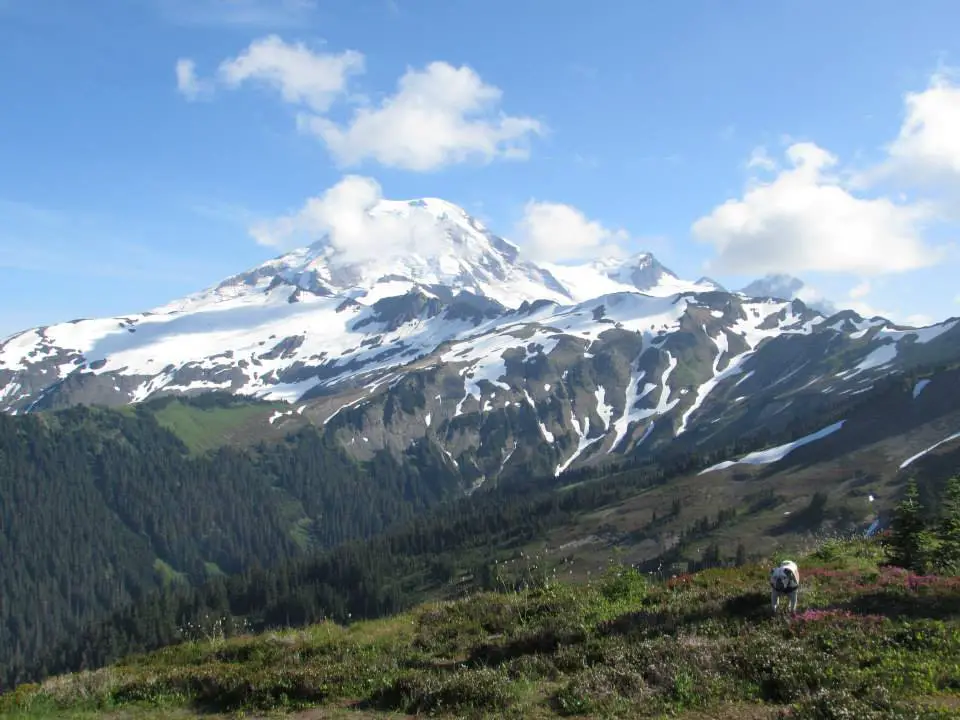
As soon as you break out of the forest and reach the ridge-line, you’ll be overwhelmed by views in every direction. The wildflowers during August are incredible. Vast fields of lupine cover the hillside as you ascend the ridge. The climb continues on a gentle grade for another 2.5 miles until you reach Chowder Ridge, which is best left for climbers with the proper equipment.
From here, Mt. Baker is so close you’ll feel like you can reach out and touch the mountain. There are also great views of Mt. Shuksan. Camping areas are plentiful throughout the hike, but be sure to bring water and clean up your camp when you leave.
9 – Mount Townsend
Round Trip Miles: 8.0
Elevation Gain: 3000
Difficulty: 3/5
Scenery: 4/5
Solitude: 2/5
Best time of year to hike: May-November
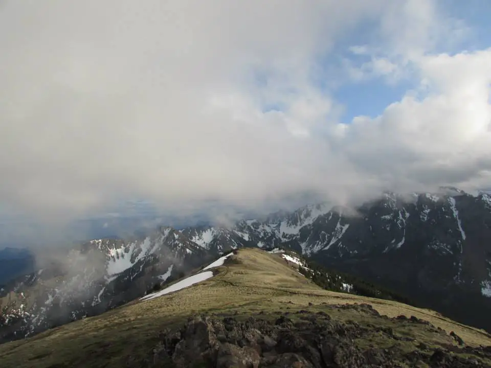
Hiking Mount Townsend is one of the few easily accessible mountain hikes on the Olympic Peninsula near Seattle. Many of the peaks in this area are difficult to access and/or require scrambling skills.
Townsend requires no scrambling and you can even bring your dog! There are multiple hiking trails to the summit, but the upper trail is the most popular.
The trail starts out with numerous switchbacks through old-growth forests, with occasional views along the way. After about 3 miles of hiking, you’ll reach an intersection with the Silver Lake trail. Stay on track and you’ll quickly break out of the forest and reach a long and wide ridge line that will take you to the summit. The summit area is massive and flat, with views in every direction.
Even if you pick a busy Saturday, there’s plenty of space to enjoy the amazing views without feeling too crowded.
10 – Laura Lake-Backdoor Trail
Round Trip Miles: 2.5
Elevation Gain: 1000
Difficulty: 3/5
Scenery: 3/5
Solitude: 3/5
Best time of year to hike: July-October
If you’re short on time, this is a perfect hike to get outside and get your heart rate going without taking up your entire day. The backdoor route is not well known, so you’re also less likely to have company on the trail.
Despite being short, this trail is steep and unforgiving. The trail starts off at an unofficial parking area at the end of FR 136. There’s no signage or bathroom facilities. The boot-path starts out very brushy as you cross Rocky Run creek.
The trail begins to climb steeply through the forest. This is less of a trail and more of a class 2 scramble. Along the way, you will pass a very pretty waterfall on your left that is worth a side trip.
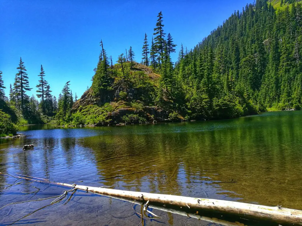
There are no signs, but a faint boot path will lead you to the base of the waterfall. After admiring the falls, get back on the main trail and keep climbing. Eventually, you’ll reach an intersection, to the left is Laura Lake, and continuing on will bring you to Lake Lillian. Make your way down the steep side trail and you’ll shortly arrive at Laura Lake.
This is a perfect spot to take a dip in the water or swim out to the island in the middle of the lake. Beware of mosquitoes in the summer.
Honorable mention: Checkout Island Lake in the North Cascades.