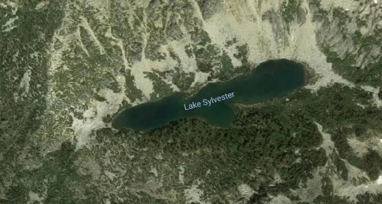
One of my favorite methods for finding hidden hikes is to use Google Maps terrain view. You can scour all over the state finding lakes and peaks or even waterfalls (although they don’t show up on the map as well). Last summer, I was doing exactly that and came across a lake called Sylvester Lake.
One of the most common complaints I hear about hiking in the Northwest is – “It’s too crowded!” Since about 2012, hiking in the Northwest has exploded. Blame social media or increasing population, but one thing is for certain – finding solitude on the trails is becoming much more difficult.
Difficult, but not impossible. Check out my guide to best hiking near Seattle for more hiking ideas.
I will mostly be writing about areas that receive little to no foot traffic, but provide all the beauty we’ve come to expect in Washington State. I’ll go over the methods I use to find these locations so that you can hopefully begin finding them on your own. 🙂
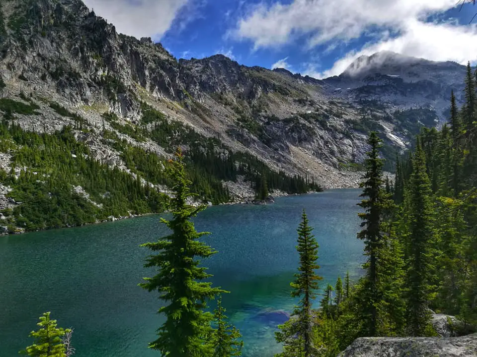
Sylvester Lake looked like a fairly substantial lake at over 6000 ft. (really high for a lake in WA) tucked between 7000 ft. peaks. My first thought was – how do I get there?
I loaded up the Basecamp software that I use with my Garmin GPS (the 62 series is excellent and highly recommended) and checked to see if there were any trails nearby.
No such luck.
So I searched the internet for any information that might tell me how to access this gem of a lake.
There wasn’t much out there, but I found just enough to get me started. Ultimately, I heard there was a rough fisherman’s trail that would take me most of the way to the lake.
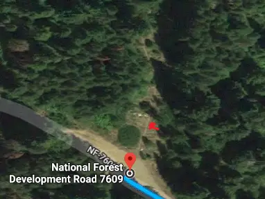
Great. I looked at Google maps again and after zooming in and searching around where I believed to be the starting area, I noticed what appeared to be a faint path.
Bingo. I marked the path on Basecamp.
Now, I just needed to figure out where to park.
Finding a parking spot in an area without designated trails is one of the hardest parts. You want to make sure you’re looking at Forest roads that aren’t closed and then you need to find a wide enough area to park without potentially blocking other vehicles.
I was able to do exactly that and found what looked like the best place to park for accessing Sylvester Lake. Then I marked as much of the fisherman’s trail as I could see on the map. And when the trail disappeared, I set markers on the terrain that looked easiest to navigate up to the lake.
I loaded all these into my GPS and there was nothing left to do but go find the lake!
I arrived at the parking area and as expected, there were no other cars. I figured I’d have the whole place to myself and I was right! The fisherman’s trail was pretty easy to spot and I started making my way up. Had no problems staying on route and the trail was pretty defined for the first 1.5 miles.

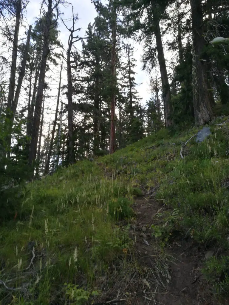
Eventually, the trail breaks out into the open and the bootpath pretty much disappears. This is standard for a hike like this.
As long as you know which direction the lake is, you should be fine (another reason it’s important to have maps or a GPS!) At this point, it’s pretty much about choosing the path of least resistance. In my case, that meant scrambling over a boulder field, which seemed to be the most accessible route.

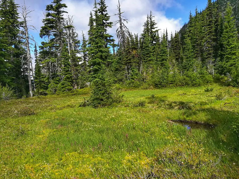
After carefully making my way through the boulders, the landscape changed to a flat meadow. I used this opportunity to catch my breath and take in the scenery. I could see on my map that the lake was close.
But I still had about 500 ft. of elevation to gain in a very short distance and there was no easy way up.

After making the final push, I reached the high point at 6,350 ft. Views opened up and I could see mountains all around me. I knew the lake was about 100 ft. below me, so I stumbled my way in its general direction.
FINALLY! The lake appeared and boy was it a sight for sore eyes. According to my GPS, it was 3800 ft of elevation gain and 3 miles to the lake, on some very rough trail.
