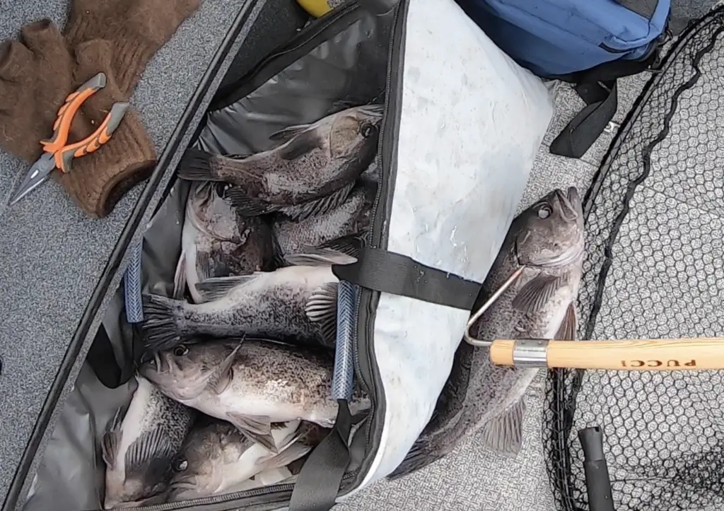
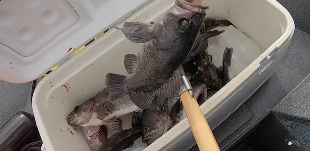
Fishing for bottom fish out of Westport, WA is one of the best opportunities in the Pacific Northwest to hook into easy limits of black sea bass and ling cod.
Fishing the open ocean always has a few things to consider when planning a trip, and launching a trip from Westport is no exception.
In this article, we go into detail about researching ocean and bar conditions as well as incredibly simple ways to rig up for the bottom fishing opportunities.
Don’t have a boat or concerned about going over the bar the first time? Consider a charter like “The Slammer” to gain valuable experience and bring home limits of delicious bottom fish.
We went in 2019 and captured some of the trip details and created some video footage of the awesome fishing experience.
You can also watch the below video from our recent trip to Westport in March 2020 in a smaller boat.
We made the trip in March 2020 before everything shut down due to COVID-19 spread and had an amazing window of nice weather, flat ocean conditions, and decent bar conditions.
Rigging up to fish for Ling Cod and Rock Fish out of Westport
Feel free to checkout my newer complete guide to lingcod fishing in Washington as well
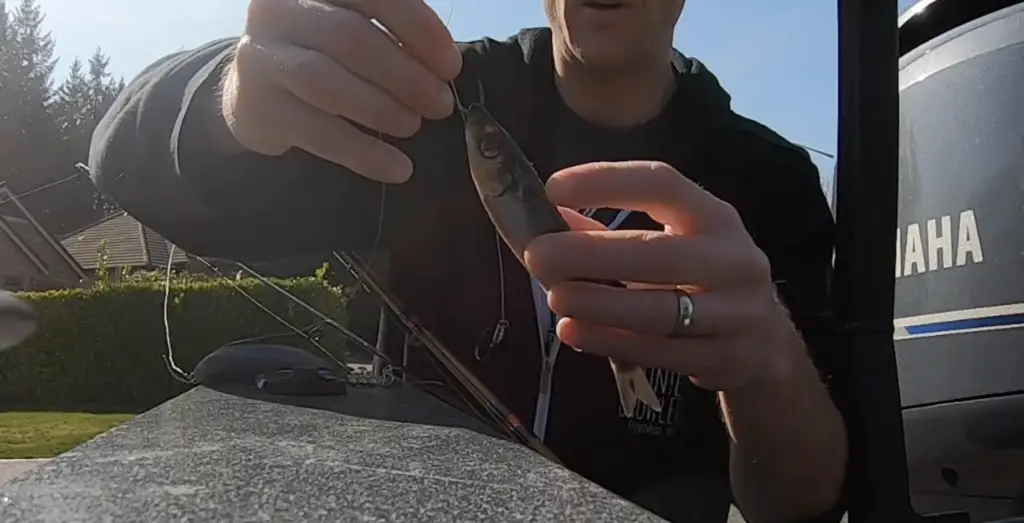
I like to use blue or green label herring, but you can also go smaller. I tie up roughly 30″ leaders using 30 lb test and use a double hook rig. The front hook is a 3/0 and the trailer is a 2/0.
I like to use the big river hooks by Gamikatsu. In the image above you can see I run the front hook up through the lip/nose of the herring.
It’s important to match the spacing between your hooks to the herring size. You want some slack to exist in the line between your two hooks.
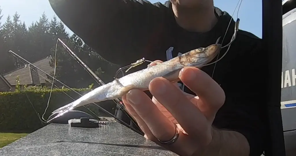
You also want the trailer hook to be lodged in the back half of the herring to maximize your opportunity to hook the ling cod or even rockfish that might bite this setup.
I tie all of this to an 8-12 oz mooching sinker. In stronger currents, you will need 10, 12, or larger mooching sinkers for 70+ feet of water.
Be careful not to let it down too fast to avoid tangling the leader around the mainline.
I like to use a lighter salmon/steelhead spinning rod rigged up with a 20 lb braided line and tie that directly to a lead jig head.
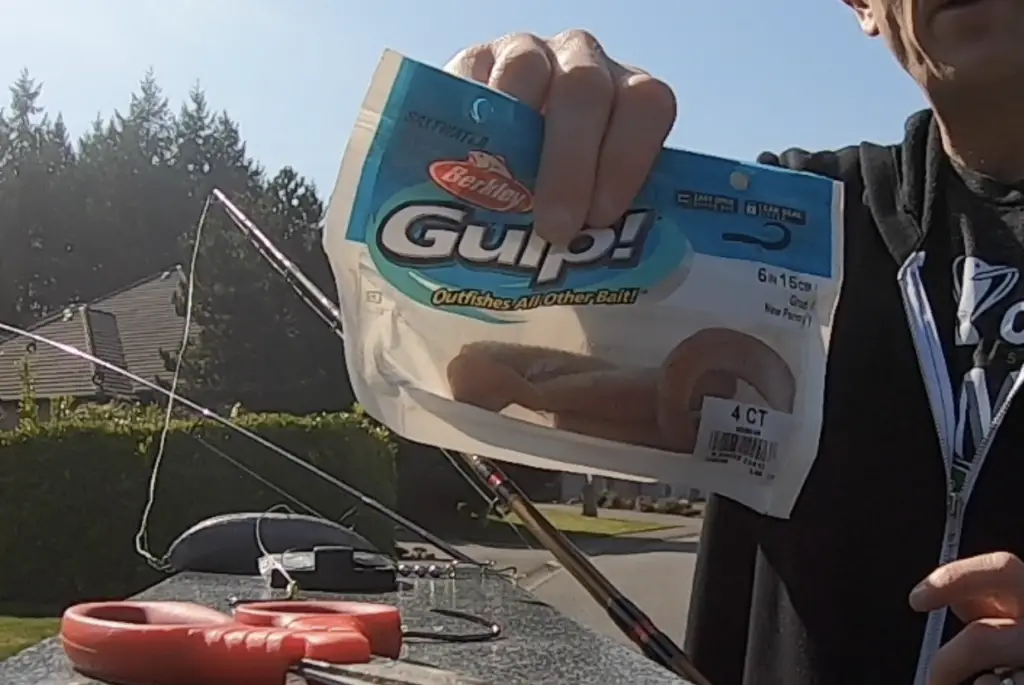
I will then put one of these 6-inch Berkley Gulp grubs in penny color onto the jig head.
These grubs got bit constantly and made for fast limits of bass. We were getting 2-5 bass per pass over our fishing area.
You can read more about fishing for lingcod here.
Planning to be safe fishing out of Westport
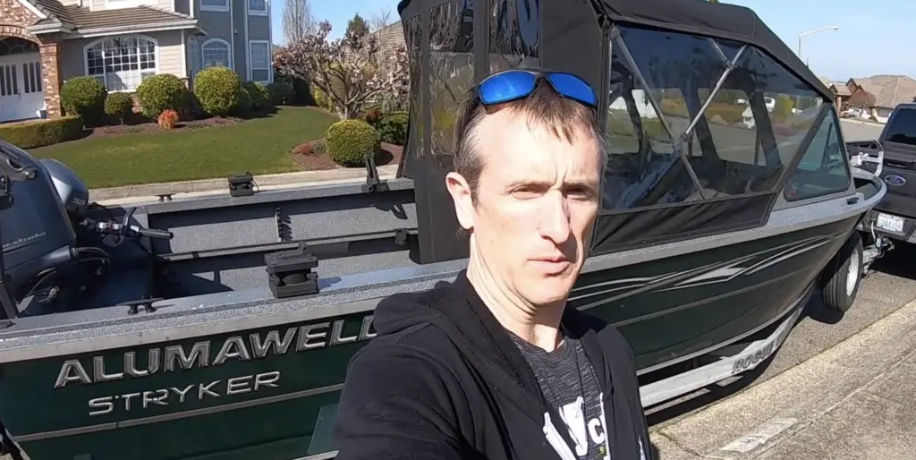
If you’re a frequent reader of this blog, you know that I once owned a 20′ jet sled with a 14-degree V that I used on the saltwater all the time.
However, I didn’t frequently go over a major river bar.
With a boat that size (and still with my larger North River), I have to carefully plan and research the conditions to keep me and my fishing crew safe.
Why is the V important to mention? A flatter V that is more common in jet boats (ideal for river navigation) will have almost no ability to cut through chop and wind waves.
This is important to realize because if you venture very far away from shelter, your ability to get back may be severely hampered.
A nightmare scenario would be going out a fair distance, realizing you need to get back due to worsening conditions, but not being able to get back quickly.
Meanwhile, the ocean and bar become extremely dangerous, forcing you to white knuckle it out and wait or take a chance and try to make it over the bar to safety.
The risk and danger is real, but it’s also not too hard to be safe and have a great time out there if you plan appropriately.
You have to consider not only the conditions at the time you plan to be out there but also what’s coming next.
Often times forecasts are wrong and bad weather arrives earlier or later than expected.
How to research and plan to stay safe going over the Westport Bar in a small boat.
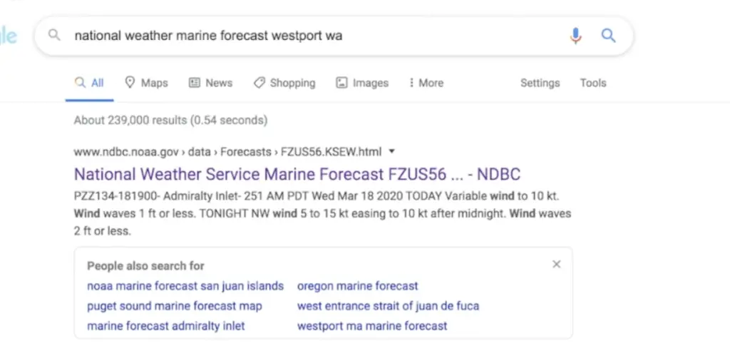
I like to start by looking at the national weather service marine forecast to get an idea what I’m dealing with.
In the above image, for the waters around Westport, you want to focus on Point Grenville to Cape Shoalwater out 10 nm.
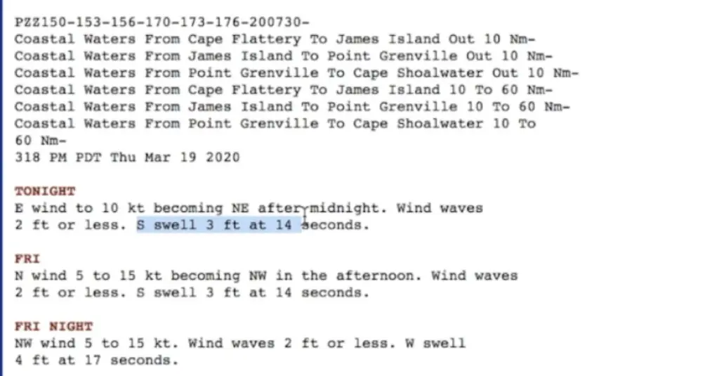
Then you want to look at the text for each period of the day.
When we crossed the bar to go out to the open ocean, we had NW swell of 3 seconds at 6 ft and 0 wind waves. 3 ft at 14 seconds (wave duration or time between waves) is quite nice and flat conditions.
If there were wind waves of 2 ft, it would not be pleasant in my boat, however, 2 ft or less could mean 0 wind waves as well.
What you really want to avoid is a square forecast.
What is a square forecast? If you add wind waves and swell height and they equal or exceed the duration in seconds, you are looking at a challenging set of conditions.
You want to avoid square forecast conditions and anything like these. You also want to be aware if these conditions could develop while you are on the water and potentially far from the sheltered water.
So we need more information.
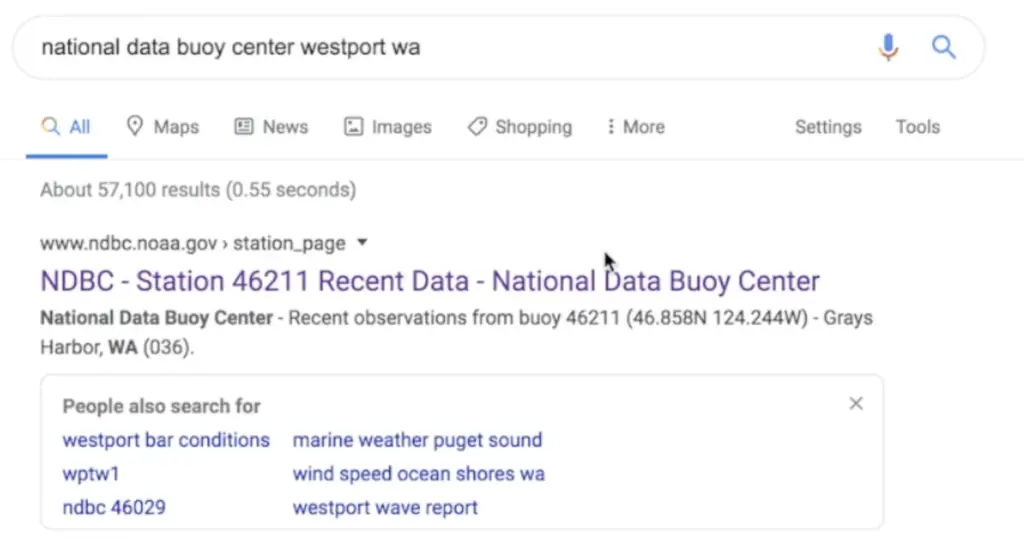
I like to go to the National Data Buoy Center that NOAA provides to get an idea of the actual conditions being recorded vs just the forecast.
Our forecast was for 3 ft at 15 seconds. What we actually experienced was 3 ft at 6 seconds.
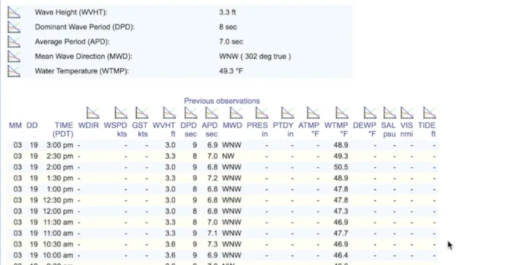
Any time the DPD (wave duration in seconds) is double or more than the WVHT (wave height in feet), it’s pretty decent conditions.
When we came back over the bar, the wave height was closer to 5 feet as the swells had gotten larger, and the duration was 8-9 seconds.
While this was still safe because they were spaced out and we didn’t have much wind, swells in that 5 ft + range were still pretty intimidating in my boat. It did however create excellent boat surfing conditions!
Again, things look good for this above captured forecast, but we need to know two other important pieces of data:
- What do we expect the wind to do while we are planning to be on the water and soon afterwards?
- What are the tidal currents doing?
If you remember the forecast above on Friday from the national marine forecast was 5 to 15 knots from the north. I don’t know about you, but the difference between a 5-knot wind and a 15-knot wind is kind of a big deal!
Why do we need to know about the tidal currents? One of the periods to avoid going over the bar is something called “Peak ebb”.
Peak ebb is the period between high tide and low tide where the ebb currents are the strongest.
These strong currents when combined with river outflows and west-ish direction swells create the largest waves the most severe breaking action and sometimes even dreaded “confused currents” which can lead to the wash machine effect.
Large river bars where this happens can create true nightmare scenarios. Sneaker waves that hit you from angles you weren’t expecting.
There are boating accidents every year on major river bars as a result of not respecting these conditions.
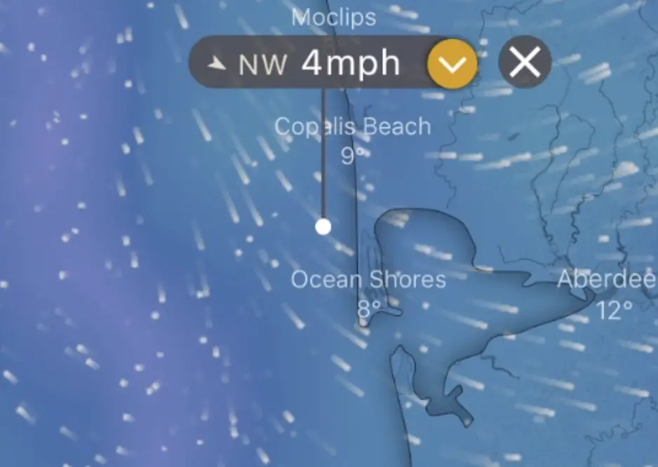
In the above screen shot from the Windy app, I selected a period in the morning on that Friday forecast. These are nice wind conditions!
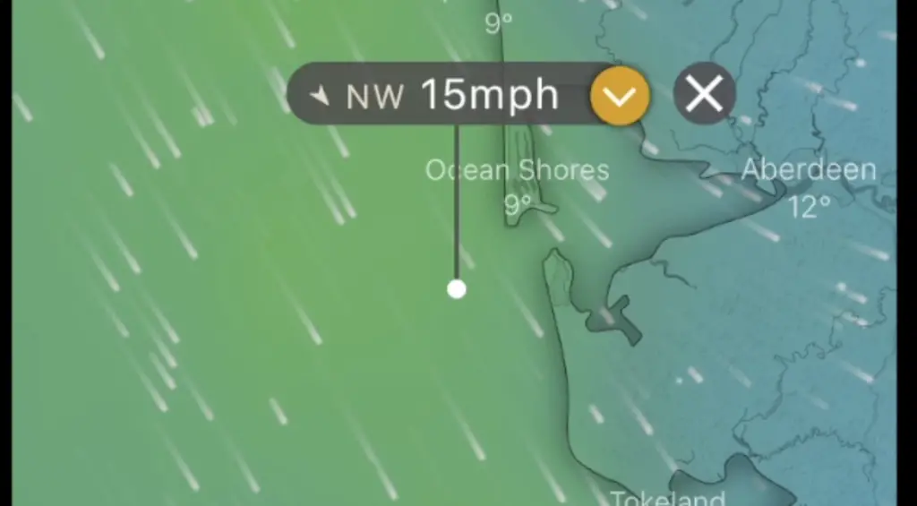
That same day I slid the slider to 4 pm and it showed the wind increasing to 15 mph, starting by around 1pm.
These are not conditions I want to be out in. I may plan to come in by noon…but what if the weather shows up earlier than predicted?
The weather could also show up way later. In fact, given this was last Friday’s situation, I know the wind never showed up until much later in the day creating great ocean conditions, but you never know.
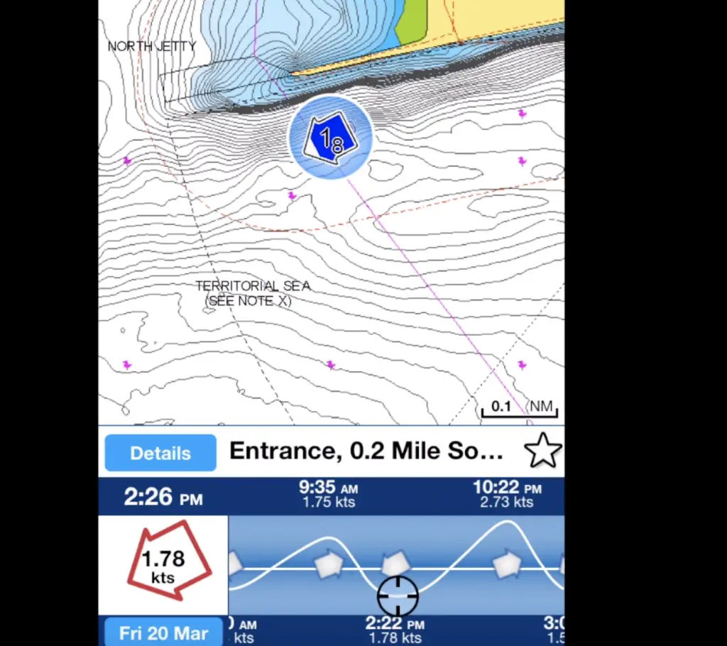
Finally, let’s look at the above data from the helpful Navionics app showing us when peak ebb flows are. This looks like it’s between 2 and 3 pm.
This is also when the weather is predicted to get worse. If I was going out that day, I would go in the morning, and I wouldn’t go far.
And I would be heading back by noon no matter what.
Summary of Westport Bottom Fishing
In summary, this is an amazingly productive fishery.
You can put high-quality tasty meat in your freezer quite fast. You do need to put some work in upfront to research and plan appropriately to be safe going over the Westport bar and coming back.
Get rigged up using the tips we provided and buy some bait.
Do some chart study to find a rock pile or stretch of rocky bottom and then go enjoy this great fishing opportunity.
nice info