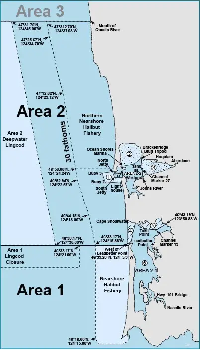
Marine Area 2 Definition: From Leadbetter Point north to the Queets River, excluding Willapa Bay and Grays Harbor
Marine Area 2-1 (Willapa Bay) Definition: east of a line from Leadbetter Point (46°39.20′ N, 124° 3.516′ W) due west to 46°39.20′ N, 124° 5.3′ W then due north to the westerly most landfall on Cape Shoalwater (46°44.66′ N, 124° 5.3′ W)
Marine Area 2-2 (Grays Harbor) Definition: east of a line from the tip of the north jetty to exposed end of the south jetty
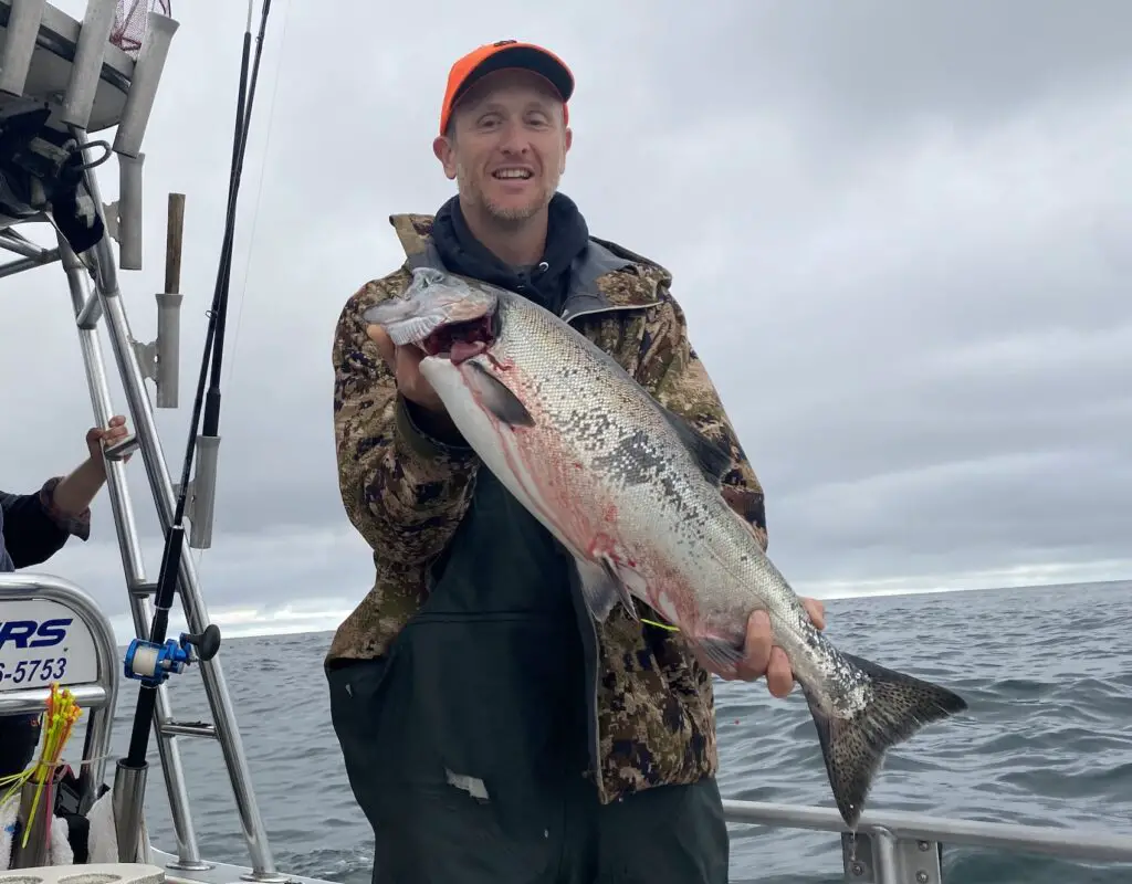
Westport / Marine Area 2 Salmon Fishing
Every year, the State of Washington represented by WDFW engages with federal regulatory bodies and tribal co-managers to figure out appropriate salmon seasons on stocks of salmon bound for their natal streams.
The process begins in March and culminates towards the end of June as salmon seasons are finalized and communicated to the public.
During this period, one needs to consult emergency regulations more so than permanent regulations for any salmon openers in that time period of March – June. I’ve described this topic extensively in my guide to understanding WDFW saltwater salmon regulations.
As the forecasts for the salmon seasons are released and made public I will post them to this page.
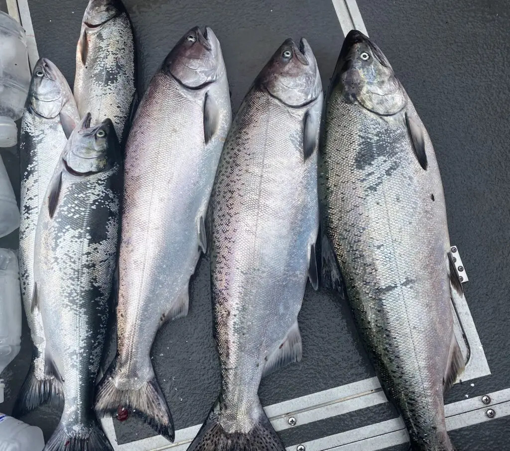
Much of the salmon caught out of Westport are headed for the Columbia River, so those forecasts will reveal a lot about what to expect fishing the Ocean in Marine Area 2.
Typically, a season for salmon out of Westport / Marine Area 2 will kick off in late June or early July and go until the quota is exhausted.
Typically, allowing retention of 2 salmon, 1 of which can be a chinook, and a requirement to release wild coho.
Again, the above are not the actual fishing regulations, but to give you an idea if you’re making trip planning decisions.
Chinook retention was modified to close Fridays and Saturdays on July 17th, 2022 due to 30% of the quota being consumed in those first two weeks of July.
So unless the chinook are hard to find, that first week of July can be a good bet.
A lot of salmon fishing out of Westport in Marine Area 2 and saltwater locations, in general, is done with downriggers. I’ve written an extensive guide to fishing for salmon with downriggers and also posted a how-to video for beginners to help you get started:
Westport / Marine Area 2 Bottom Fishing
Fishing for a variety of bottom fish out of Westport in Marine Area 2 can be fantastic when the season is open. This typically occurs from the second Sat. in March until the Third Sat. in October.
Note: Halibut is different, and has special opening days linked below and a quota system.
For Lingcod, you should refer to the permanent regulations as there are a variety of day periods such as the deepwater lingcod fishery, which determines what depths and areas can be fished throughout the season.
For ideas on how to fish for lingcod off Washington coastal waters see this link.
Catching rockfish in our nearshore waters off of the Washington coast provides some of the best and easiest angling opportunities.
Look for any rock piles in water depths typically < 100 ft and you will find significant populations of rockfish. I wrote this blog post in early 2022 to help you prepare a variety of riggings to get super-efficient limits of rockfish.
I’ve also completed a very comprehensive page on how to catch rockfish.
The below video was shot in Marine Area 2 with a trip in April, 2022 out of Westport.
Halibut Fishing out of Westport / Marine Area 2
Here’s a link to the WDFW page on halibut fishing in Marine Area 2. It should get updated as seasons and quota are announced, but there’s a good description of what you can expect if you are trying to make trip planning decisions.
Staying safe while fishing out of Westport / Marine Area 2
While the Columbia River bar is the more dangerous bigger brother of river bars, the Westport / Grays Harbor bar should not be taken lightly in any way.
In the wrong conditions, this bar can absolutely sink boats.
I highly recommend booking a charter if it’s your first time going over a serious river bar, and even if it’s just your first time going over the Grays Harbor bar, a charter can give you an idea of how a professional navigates this critical stretch of water.
I’ve written a page on marine weather safety that’s extensive and one of the best references I’ve found that’s free on the internet, which attempts to explain many of the concepts you need to understand heading over river bars and making trip planning decisions to fish the ocean.
Here’s a video I posted about going over the Westport bar in a smaller boat:
I now own a more serious offshore boat, but I still take trip planning extremely seriously whenever venturing over a river bar or into big water in general.
Tides / Marine Forecast for Westport / Point Chehalis and coastal waters from Point Grenville to Cape Shoalwater out 10 nm
Please use caution regarding the below information as this feature is new and may encounter bugs that result in inaccurate or stale information being displayed.
Marine Forecast for Coastal Waters From Point Grenville To Cape Shoalwater Out 10 Nm as of 0 days and 17 hours ago
Forecast may be too old to safely rely on!Forecast published on 08/01/2026 01:41:00 Synopsis: SYNOPSIS FOR THE NORTHERN AND CENTRAL WASHINGTON COASTAL AND INLAND WATERS...A weak frontal system will push across area waters today. High pressure will rebuild over the coastal waters Sunday and remain in place into early next week as thermally induced low pressure expands northward across the interior.
You should always check the forecast on the NWS Marine Forecast Page, the text below is added for your convenience:
Question about how to read a marine forecast to stay safe? Check out our comprehensive guide on Marine Weather Safety here
Yesterday's last tide
| Tide Time (24H) | Predicted (ft) | High-Low | Tide Delta | Avg ft / hour |
| 20:44 | 2.18 ft | L | NA | NA |
08/01/2026 Sat
Hazardous Weather:
Daytime Marine Forecast: W wind 10 to 15 kt. Seas 3 to 5 ft. Wave Detail: W 4 ft at 8 seconds and SW 2 ft at 14 seconds. Rain likely early this morning.
| Tide Time (24H) | Predicted (ft) | High-Low | Tide Delta | Avg ft / hour |
| 02:46 | 8.39 ft | H | 6.21 | 1.03 |
| 09:06 | -0.68 ft | L | -9.07 | -1.43 |
| 15:48 | 7.98 ft | H | 8.66 | 1.29 |
| 21:24 | 1.82 ft | L | -6.16 | -1.10 |
08/02/2026 Sun
Daytime Marine Forecast: NW wind 5 to 10 kt, rising to 15 to 20 kt in the afternoon. Seas 4 to 6 ft. Wave Detail: W 6 ft at 9 seconds.| Tide Time (24H) | Predicted (ft) | High-Low | Tide Delta | Avg ft / hour |
| 03:25 | 7.94 ft | H | 6.12 | 1.02 |
| 09:36 | -0.22 ft | L | -8.16 | -1.32 |
| 16:19 | 8.16 ft | H | 8.38 | 1.25 |
| 22:07 | 1.48 ft | L | -6.68 | -1.15 |
08/03/2026 Mon
Daytime Marine Forecast: N wind 5 to 10 kt, becoming NW 10 to 15 kt in the afternoon. Seas 4 to 6 ft. Wave Detail: NW 3 ft at 7 seconds and W 5 ft at 8 seconds.| Tide Time (24H) | Predicted (ft) | High-Low | Tide Delta | Avg ft / hour |
| 04:10 | 7.38 ft | H | 5.9 | 0.98 |
| 10:08 | 0.43 ft | L | -6.95 | -1.16 |
| 16:50 | 8.33 ft | H | 7.9 | 1.18 |
| 22:56 | 1.19 ft | L | -7.14 | -1.17 |
08/04/2026 Tue
Daytime Marine Forecast: N wind 5 to 10 kt, becoming NW 10 to 15 kt in the afternoon. Seas 3 to 5 ft. Wave Detail: NW 5 ft at 8 seconds.| Tide Time (24H) | Predicted (ft) | High-Low | Tide Delta | Avg ft / hour |
| 05:01 | 6.73 ft | H | 5.54 | 0.91 |
| 10:43 | 1.23 ft | L | -5.5 | -0.96 |
| 17:26 | 8.48 ft | H | 7.25 | 1.08 |
| 23:53 | 0.94 ft | L | -7.54 | -1.17 |
08/05/2026 Wed
Daytime Marine Forecast: NW wind 10 to 15 kt. Seas 5 to 7 ft. Wave Detail: W 7 ft at 9 seconds.| Tide Time (24H) | Predicted (ft) | High-Low | Tide Delta | Avg ft / hour |
| 06:05 | 6.11 ft | H | 5.17 | 0.83 |
| 11:24 | 2.10 ft | L | -4.01 | -0.75 |
| 18:09 | 8.59 ft | H | 6.49 | 0.96 |
08/06/2026 Thu
| Tide Time (24H) | Predicted (ft) | High-Low | Tide Delta | Avg ft / hour |
| 00:57 | 0.69 ft | L | -7.9 | -1.16 |
| 07:24 | 5.65 ft | H | 4.96 | 0.77 |
| 12:19 | 2.94 ft | L | -2.71 | -0.55 |
| 19:03 | 8.67 ft | H | 5.73 | 0.85 |
Looking for more tides? Checkout the NOAA Tide Prediction page for Westport, Point Chehalis here
Westport / Marine Area 2 Fishing Regulations
Here’s a link to WDFW’s marine area rules and definitions.
Marine Area permanent regulations are updated in late June / early July of the year as salmon seasons are finalized, and you can access the current Marine Area 2 regulations here.
Emergency Fishing Regulations for Westport / Marine Area 2
The above permanent regulations for Marine Area 2 are subject to change at any time and without being updated on this blog. One must consult the WDFW Emergency Regulations before any trips to ensure they are in full compliance with state laws regulating fisheries.